
Wildland Fire
It is not a matter of “if” another wildfire will occur in our area, but “when.”
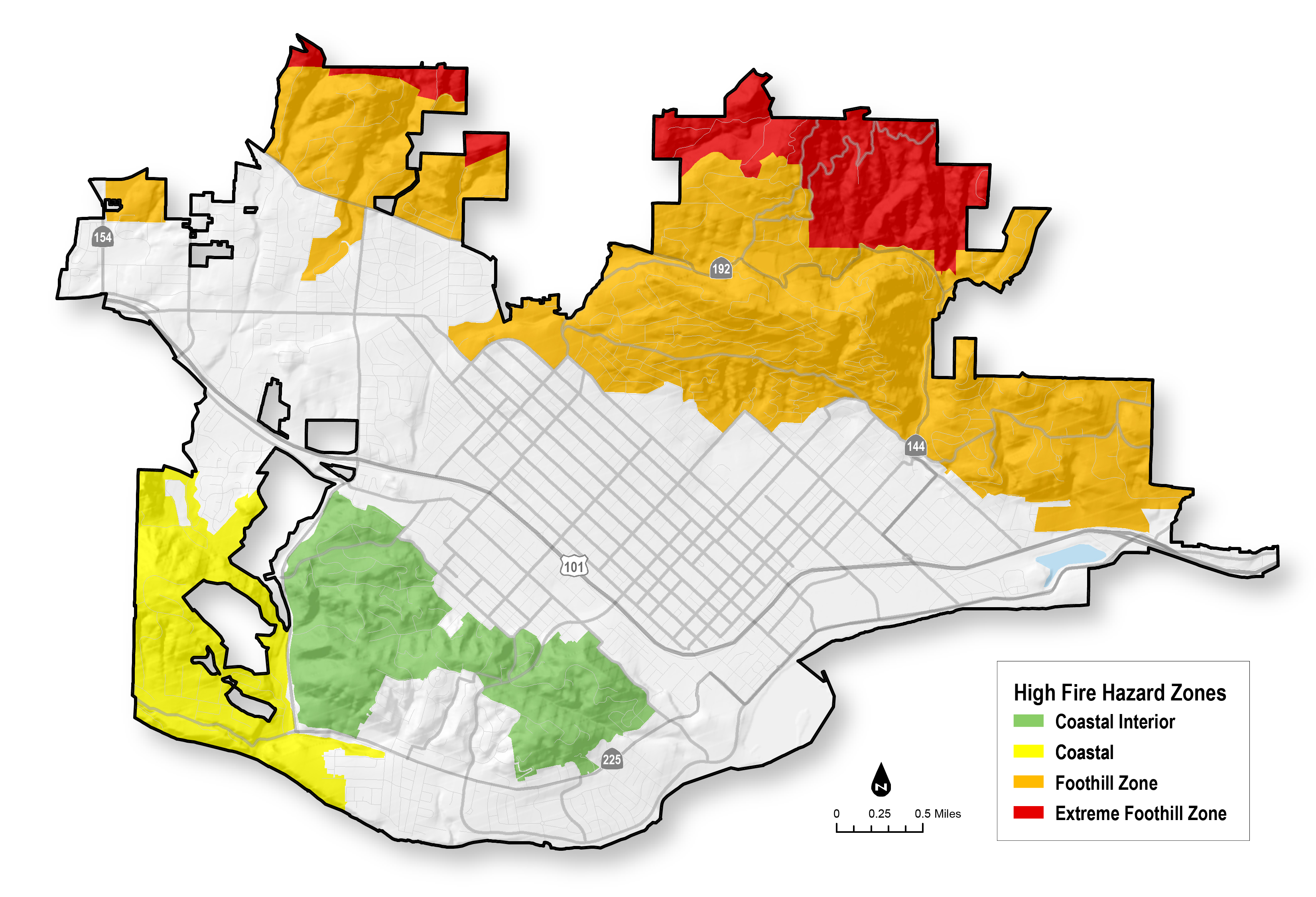
If your property is located within the City of Santa Barbara high fire hazard area you are at risk of damage from a wildland fire.

Coastal Wildland Fire Suppression Assessment
The Coastal Wildfire Suppression Assessment District was approved on June 30, 2026.
The assessment will fund a coordinated set of wildland fire prevention and mitigation services within the Coastal and Coastal Interior High Fire Hazard Areas:
- Roadside vegetation clearance
- Defensible space vegetation chipping
- Vegetation management
Defensible Space and Home Hardening

Press Release on Updated Safety Plans with New Fire Hazard Zone Maps
Click the link below to view the press release on the updated safety plans with the new fire hazard zone maps.
City of Santa Barbara High Fire Hazard Zones

Effect of the Drought
It is generally accepted that there is a connection between drought and wildfire, a risk that increases with multiple dry years. The California Department of Water Resources observed that California’s most devastating wildland fire episodes occurred either during a drought or in the year following a multi-year drought. Low fuel moisture creates conditions that are favorable to fire spread, and resulting outbreaks can be among the major economic impacts of drought conditions. Approximately 75% of wildland fire causes are associated with the activities of people, from deliberate sets to household ignition sources and to driving cars. That makes the urban wildland interface particularly prone to fire initiation and spread.